WFSTFeatureEditing UX
Modify vector features on an interactive map using a rich and easy to configure editing tool
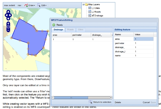
The demo features a widget that automatically creates all tools required to accomplish WFS-T editing using GeoExt, OpenLayers, ExtJS, GXP and TinyOWS.
More details are available directly on the demo page.